Synonym: Geothermal Temperature Profile = Geotherma
Natural subsurface temperature profile along the True Vertical Direction:
T_G(z), where
z is True Vertical Depth Sub-Sea (TVDss).
It is essentially a true vertical component of local Geothermal Temperature Field
T_G(x, \, y, \, z).
Many subsurface studies are focused on Sedimentary Cover below a specific surface area where lateral \{ x, \, y \} variation of Geothermal Temperature Field T_G(x, \, y, \, z) maybe insignificant comparing to variation along the true vertical direction \{ z \}.
This happens, for example, at the lateral scales of a typical Petroleum Field and allows modelling Geothermal Temperature Field with a laterally constant Geothermal Temperature Profile T_G(z).
The high level overview of Geothermal Temperature Profile in given at Fig 1.
| |
| Fig. 1. Schematic picture of Geothermal Temperature Profile of the Earth. | Fig. 2. A sample of Geothermal Temperature Gradient in Sedimentary Cover of the Earth's Crust. |

|
|
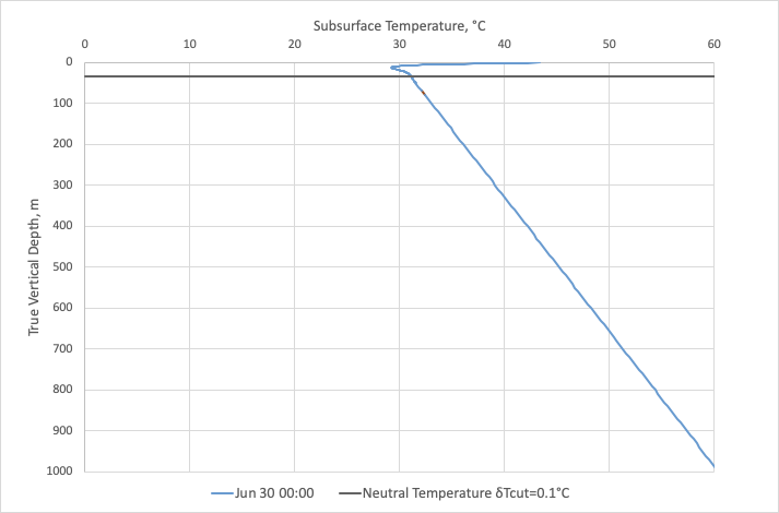
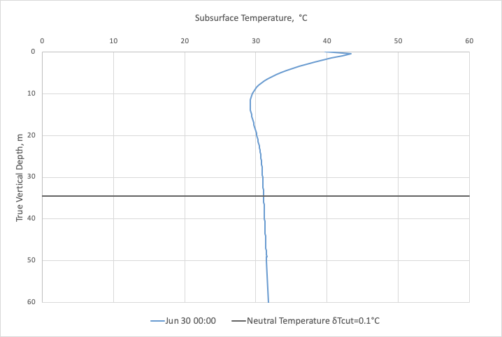
| Fig. 3.1. A sample of Geothermal Temperature Profile captured at a certain time moment when surface temperature was higher than annual average. | Fig. 3.2. A sample of Geothermal Temperature Profile with depth zoom around temperature variations above Neutral Temperature Layer captured at a certain time moment when surface temperature was higher than annual average but lower than monthly average. |
|
|
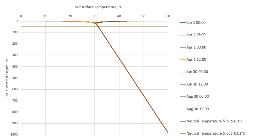
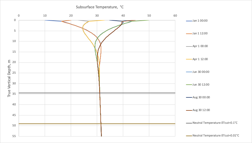
| Fig. 3.3. A sample of Geothermal Temperature Profile captured at different time moments. | Fig. 3.4. A sample of Geothermal Temperature Profile captured at different time moments with zoom around temperature variations above Neutral Temperature Layer |
See Also
Geology / Geothermal Temperature Field
[ Petroleum Geology ][ Geological Model (GM) ] [ Neutral Temperature Layer (NTL) ]
[ Geothermal Temperature Profile @model ]
Reference
GeothermalTemperatureProfile.xlsx